
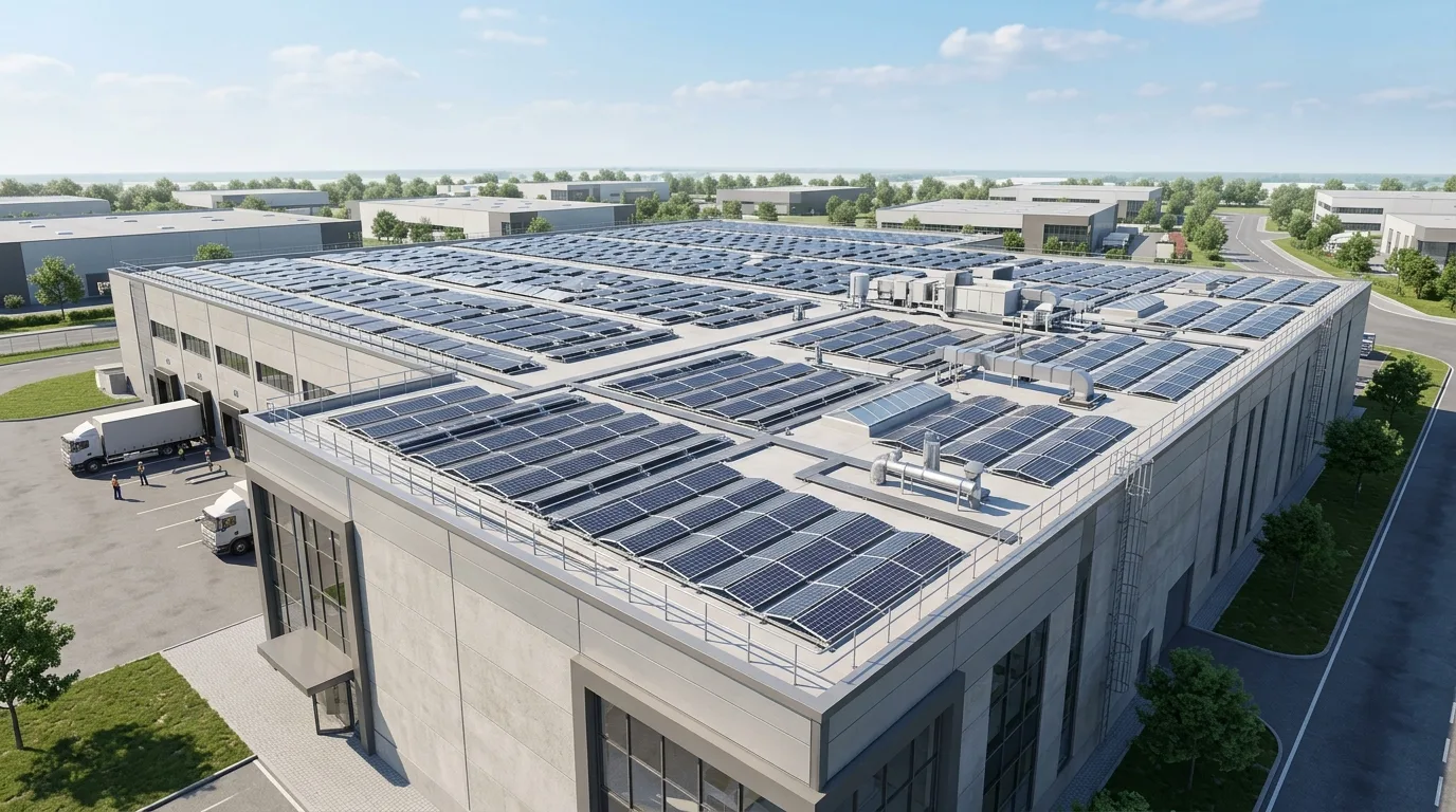
Solar EPC
Solyug Energy 3D Solar Engineering & Design Model
Drone LiDAR & Topographic Survey

Solar Site Survey &
Feasibility Services

Every solar project's accuracy starts before a single drawing is made it starts with knowing exactly what the site can and can't support. Solyug Energy's site survey and feasibility services give EPCs and developers a clear, data-backed picture of land or roof viability before committing engineering hours to a design that might not work on the ground.

Pre-Engineering Site Validation: We conduct high-precision drone photogrammetry, contour mapping, soil resistivity tests (Wenner 4-pin), and rooftop structural audits across Gujarat, Maharashtra, Rajasthan, and Pan-India — preventing costly civil re-engineering and ensuring 100% bankable DPR generation.

±2 cm
Drone Mapping Precision
520+ MW
Surveyed & De-risked
100%
Bankable DPR Compliance
CORE FEASIBILITY PILLARS

Why Solar Feasibility Precedes Design

Comprehensive ground and rooftop site verification eliminates project execution bottlenecks before capital deployment.

Topographic Contours & GIS DEM

High-resolution contour mapping (0.5m intervals), Digital Elevation Models (DEM), and slope analysis to optimize table grading and tracker alignment.

Geotechnical & Soil Resistivity

Borehole soil sampling, pile pull-out testing, and Wenner 4-pin electrical resistivity for safe foundation and earthing grid design.

Rooftop Structural Assessment

Purlin spacing audits, live/dead load calculations, and wind stress verification certifying structural safety under IS 875 Part 3.

Grid Evacuation Feasibility

Interconnection distance, feeder capacity, substation switchyard layout, and transmission line Right-of-Way (RoW) viability checks.

Pre-Engineering Feasibility

Why a Site Survey
Comes Before Design

Assumptions made in CAD offices without verified ground truth lead to foundation settling, cable trench rerouting, and DISCOM rejection. Our pre-engineering surveys establish exact civil, electrical, and legal boundaries before capital commitment.

Preventing On-Site Structural Rework & Capacity Derating
3D Site Verification
Pre-Engineering Validation

Preventing On-Site Structural Rework & Capacity Derating

A design built on assumptions about land contours, soil bearing capacity, roof structural condition, or shading obstructions is a design that gets revised expensively during execution. We've seen projects lose weeks to structural rework because a rooftop's load-bearing capacity wasn't verified upfront, or lose generation capacity because a nearby obstruction wasn't accounted for in the layout. A proper feasibility study removes that risk before it becomes a cost.

Validates geotechnical soil strata, rooftop dead/live loads, and near-shading profiles.

Verified site survey measurements feed directly into our Detailed Engineering Design and 3D Shadow Analysis workflows, ensuring zero discrepancy between ground reality and final installation blueprints.

COMPREHENSIVE SURVEY DELIVERABLES

Feasibility Study Deliverables

Every solar site survey and feasibility report delivers actionable, bankable engineering documentation designed for direct handover to EPC planners, structural engineers, and permitting authorities.

Topographic & Site Audit Report

Site assessment report (structural or topographic, as applicable)

3D Solar Shadow & Obstruction Mapping

Shading/obstruction map with estimated generation-loss percentage

Deliverables Rooftop Solar Layout

Preliminary capacity estimate based on available area

Maximized DC string capacity and optimum ground coverage ratio (GCR) calculations based on actual boundaries.

Technical Risk & Red-Flag Audit

Risk flags for anything that would require design compromise or additional cost

Engineering Handover & CAD Models

Design-ready inputs handed directly to our Detailed Engineering Design and 3D Design teams

Accurate
Reliable
Sustainable
Engineered
Execution Workflow

Our Site Survey Process

Our solar rooftop 3D modeling process moves through four stages, from raw site data to a client-ready presentation file.

1
2
3
4
01
Stage 01

Data Collection

Site photos, available land/roof drawings, and where possible a physical or drone-based site visit.

Scroll wheel to advance · Stage 1 of 4
METHODOLOGY & SCOPE

What Our Feasibility Study Covers

Our site survey and feasibility framework systematically evaluates every terrain, structural, meteorological, and grid interconnection parameter to ensure zero execution surprises.

LAT: 21.1458° NLON: 79.0882° E
TOPOGRAPHY & TERRAIN

Topographic & Geotechnical Survey

For MW-scale ground-mounted projects, we assess land topography, soil type indicators, drainage patterns, access road feasibility, and boundary/area verification against available land records. This directly informs your row-spacing, cut-and-fill requirements, and foundation design decisions before detailed engineering begins.

95%
Limit Check: OK
Grid Codes: Match
Phase Sync: Passed
STRUCTURAL INTEGRITY

Rooftop Load & Structural Assessment

For rooftop and C&I projects, we assess existing structural condition, available load-bearing capacity under IS 875, roof type and slope, available mounting area after accounting for existing rooftop equipment, and access pathways for installation and maintenance.

SLD Generation Flow Active
SUN-PATH & LOSS SIMULATION

3D Shading & Obstruction Analysis

We identify near-shading (parapets, HVAC units, adjacent structures) and far-shading (trees, neighboring buildings, terrain) obstructions using sun-path analysis, giving you real generation-loss estimates before layout finalization — not after installation.

Near-Shading Loss
< 1.5% Loss
Annual Specific Yield
1,650+ kWh/kWp
GRID EVACUATION & INTERCONNECTION

Evacuation & Substation Feasibility

For larger projects, we assess proximity to substations, likely evacuation voltage level (11kV / 33kV / 66kV / 132kV), and any preliminary grid-connectivity constraints that could affect project sizing or phasing.

Global Footprint

India, Africa & Gulf Feasibility

Having delivered 520MW+ across India, Africa, and the Gulf, we've run feasibility studies across widely different terrain, climate, and regulatory conditions from high-wind coastal ground-mount sites to dense urban C&I rooftops.

Loading compliance map data...
Adaptive Survey Scope: 20 Indian States & Gulf Locations

Frequently Asked Questions

Chat with us